
Advent of Code 2018 Day 6
Try the simulator using your puzzle input!

Task: Solve for X where...
Part 1
X = the size of the largest area that isn't infinite
Part 2
X = the size of the region containing all locations which have a total distance to all given coordinates of less than 10000
Example input
1, 1
1, 6
8, 3
3, 4
5, 5
8, 9
It represents:
- A list of coordinates
- They may be safe or dangerous
- They exist among a 2D grid that extends infinitely in all directions
- Only the coordinates that have a finite amount of adjacent coordinates whose Manhattan distance is closest to the source coordinate are considered safe
Part 1
- Outlining the steps required to render my input's 2D grid
- Step by step
- Completing step 5/5
- Filtering, counting, hoping
Outlining the steps required to render my input's 2D grid
- Parse the input for each
X,Ycoordinate - Determine the frame of the area that bounds my coordinates
- Assign each coordinate a unique symbol
- Render the 2D grid containing just the target coordinates
- Render the 2D grid with all other coordinates marked using the symbol of the target coordinate that has the closest Manhattan Distance
Step by step
Steps 1-4 were straightforward.
Within a half hour, I wrote an ~14-line algorithm that generated the 2D grid with each target coordinate placed, and built a simulator to render the grid at the press of a button.

Completing step 5 would take a bit more effort.
Completing step 5
After another half hour, I wrote another ~14-line algorithm that processed every coordinate in my 2D grid, determining its Manhattan Distance to each target coordinate, and setting either the symbol of the closest coordinate, or a . to indicate a tie for closest targets

The last bit of work is:
- Filtering out characters that touch the edge of the visible grid, since they go on forever
- Tallying the counts of each character
- Determine the largest tally
- Cross my fingers that it's the correct answer
Filtering, counting, hoping
Determine all symbols that occupy the edge of the visible grid, since they go on forever
Generate a subset of symbols, excluding the ones identified just now
Create a dictionary that will store keys for each symbol in the subset, and tallies for each occurrence as values
Count each instance
Return the largest count
The results:
- It worked on the example input!
- It worked on my puzzle input!
Part 2
- Could it be that easy?
- Yes, it could!
Could it be that easy?
- My algorithm already calculates the Manhattan Distances from each target coordinate...for each cell in the framed grid
- For Part 1, I checked for the smallest number among those distances
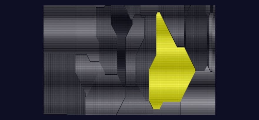
- For Part 2, I just need to add them together and check whether the sum is less than 10000
- If it is, I'll mark the cell with a
# - Else, I'll mark the cell with a
. - That will hopefully reveal the region
Yes, it could!
Viola!
I did it!!
- I solved both parts!
- I made a simulator that helped me solve each part!

Top comments (0)