The sentinel 1 imagery is the freely available SAR dataset. The dataset can be downloaded from the Copernicus Open Access Hub.
The snap Toolbox is an open source software for processing the sentinel products. The snap software provides the interactive GUI to process the raster dataset.
A flood is an overflow of water that submerges land that is usually dry. It is very common type of hazard which mainly occur in rainy season. The flood mapping can help to plan and mitigate the risk.
In this article, I am going to write about the flood mapping technique using SAR dataset provided by sentinel 1 imagery on Snap Toolbox. The overall methodology for flood mapping will be looks like this,
Need to upload an methodology image
Download data and load it into Snap Toolbox
You can download the data freely from Copernicus Open Access Hub. You need to download the data before and after flood event. Lets say, if the flood event happen in July 31, you need sentinel 1 dataset before July 31 and after July 31. You can filter the data as below,
- Draw the boundary on your study area.
- Under mission sentinel 1, select satellite platform as
S1A_* - Select product type as
GRD - Click the search button

The downloaded data will be in .zip format. Don't worry, Snap Toolbox can read the data directly from .zip format.
Please note that before applying any correction, the data will load in random orientation. I mean, the map will not be north oriented.
Mask data to the Area of Interest
To mask the dataset, you need to zoom the dataset to your area of interest. Under raster menu, you will find the Subset option, from where you can crop the data to the required area.
To view two image side by side, you might need to
view > syncronise image viewsandWindow > Tile evenly.
Multilooking
It is the process for reducing the size of the image. It might also reduce some spackles on the image. It is totally optional, if you need the high resolution output, don't do this step. The multilooking feature is available here: Radar > SAR Utilities > Multilooking.
Radiometric Calibration
The objective of SAR calibration is to provide imagery in which the pixel values can be directly related to the radar backscatter of the scene. Though uncalibrated SAR imagery is sufficient for qualitative use, calibrated SAR images are essential to quantitative use of SAR data. The feature is available here: Radar > Radiometric > Calibrate.

If you want to visualize the image more nicely, you can convert it to the dB by simply
right click on the image > Linear to/from dB.

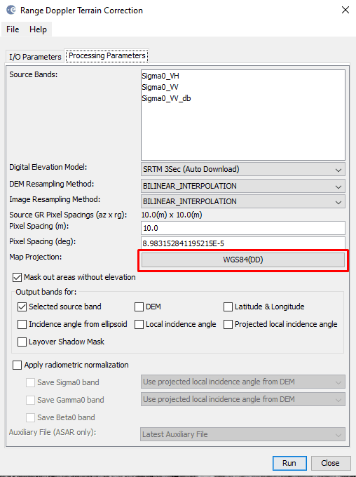
Terrain correction
Due to topographical variations of a scene and the tilt of the satellite sensor, distances can be distorted in the SAR images. Image data not directly at the sensor’s Nadir location will have some distortion. Terrain corrections are intended to compensate for these distortions so that the geometric representation of the image will be as close as possible to the real world. After applying this correction, the image will be correctly oriented. You can leave all the parameters as default value. This feature is available here: Radar > Geometry > Terrain correction > Range Doppler Terrain Correction.
Create stack
After applying the radiometric and geometric correction, you need to create the composite band, i.e. need to stack the both images into one. To do so, you need to convert the image to band and save the product. After that, you need to create the stack, the tool is available here: Radar > Coregistration > Stack Tools > Create Stack.


After that now you can visualize the products and see the difference between two maps. For better visualization you can make the RGB image using window > Open RGB Image Window as below,

Your final product will look like this,

If you like this blog, please subscribe to my YouTube channel for more contents related to GIS and Remote Sensing topics: https://www.youtube.com/c/iamtekson

Top comments (0)